

• Today's wars are fought with more than just weapons and vehicles. They are also combated using intelligence, technology, and information. Satellites are one of contemporary warfare's most essential tools. These celestial eyes can see everything from a great distance. In India, the Indian Space Research Organisation (ISRO) is well-known for its benign space missions.
• However, when the nation requires assistance during times of crisis, ISRO's satellites become a silent force. Satellite technology played an essential part in the recent confrontation between India and Pakistan. Let's look at how ISRO satellites assisted the Indian military throughout times of tension and conflict.
ISRO, a peaceful agency with powerful technology.
• ISRO was founded in 1969 with a peaceful goal: to use space technology to benefit the general public. It launched satellites for meteorology, communication, agriculture, and education. However, when challenges to national security rose, India began to use its space technology for military as well.
• Although ISRO is not a military agency, several of its satellites have dual-purpose. This means they can be utilized in both civilian and military applications. These satellites deliver high-quality photos, track weather, facilitate communication, and, most critically, provide surveillance.
Kargil War (1999): A Turning Point.

• During the 1999 Kargil War, Indian soldiers had to fight at high elevations, not knowing where the opposition was hiding. At the time, India lacked robust satellite surveillance capabilities. The country has to rely on historical photographs and international assistance. The war was a wake-up call for India. It demonstrated the need for real-time satellite imagery. Soon after the war, ISRO began focused on launching satellites to aid in national security and border monitoring.
How Satellites Help in Conflicts
• Let's look at how satellites can help in a war or conflict situation.
Surveillance: Satellites capture high-resolution photographs of the ground, allowing the army to identify adversary locations and movements.
Night Vision: Radar technology enables some satellites to see at night and through clouds.
Communication: Satellites enable army bases stay in communication, especially in remote places where cell networks do not exist.
Weather Updates: Weather is an important factor in mission planning, particularly for airstrikes. Satellites give precise weather information.
Damage Assessment: Following an attack, satellites can gather photographs to determine how much damage was caused.
ISRO's Key Defence Satellites Over the years:
1. Cartosat Series.

These satellites capture sharp images of the Earth's surface. They assist in tracking enemy bunkers, vehicles, roads, bridges, and even changes in scenery. Cartosat photos were extremely beneficial for planning and tracking actions along the India-Pakistan border.
2. Radar Imaging Satellites (RISAT Series)
They can see through clouds, smoke, and even at darkness. This is especially important in locations like Kashmir, where the weather varies fast. RISATs provide 24-hour surveillance.
3. GSAT Series:

These are communications satellites. They enable the military to communicate safely, even in remote border areas.
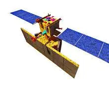
4. EMISAT
.webp)
This satellite, which was launched in 2019, is capable of tracking hostile radar and electronic signals. This provides a significant advantage in air defense and electronic warfare.
Balakot Air Strike (2019): An Actual Example
• Following a deadly terrorist assault in Pulwama, India launched an airstrike in Balakot, Pakistan, on February 26, 2019. This endeavor was a major challenge. The Indian Air Force had to send planes across the border and strike terrorist camps while avoiding detection.
• Here's how the ISRO satellites helped: Before the strike, Cartosat and RISAT satellites provided detailed photographs of the terrorist camp, its layout, and movement in the region. The Air Force used satellite maps to determine the safest and fastest path to Balakot. Weather satellites ensured that there were no storms or clouds to disrupt the mission.
How India Uses Satellites During Border Tension
• India and Pakistan have had a long history of border conflicts. In such cases, real-time information is critical. Here's how ISRO's satellites assist every day: Keep a watch on infiltration attempts over the Line of Control (LOC). Monitor the movements of troops and vehicles near the border. Track terror launch pads and training camps in Pakistan-occupied Kashmir (PoK). Share data with agencies such as RAW, DRDO, and the Indian army. Support operations during surgical strikes and patrolling.
Defense Space Agency (DSA): Coordination with ISRO.
• In 2019, India established the Defense Space Agency. This agency collaborates with ISRO and the Defence Research and Development Organisation (DRDO). Its mission is to exploit space technology for national security and plan how to fight in space if necessary in the future. With DSA in motion, ISRO is better tied to military needs. This strengthens India's space and defense capabilities.
A Message of Peace with Power
• Although ISRO supports military operations, its primary purpose remains peaceful. India has long stated that it does not seek war, but if necessary, it is prepared to defend itself. Using satellites does not imply beginning a conflict; rather, it means averting one by remaining awake and informed. ISRO's contribution demonstrates how technology may save lives, prevent misunderstandings, and maintain national security.
Share your thoughts in Comments!


0 Comments